Page
20
|
Page
20
|
The Borah Peak Area & the October, 1983 Earthquake
Intermountain
Seismic Belt
Active faulting continues
today along the eastern margin of the Basin and Range Province, along what
is known as the Intermountain Seismic Belt. This belt extends from Salt
Lake City along the Wasatch Range through Logan, Preston, to Soda Springs,
and then north to Star Valley, Jackson Hole, and Yellowstone Park. Another
branch of this belt extends generally northeastward through central Idaho
from near Stanley and the Sawtooth Mountains through the Lost River, Lemhi
and Beaverhead Ranges to Yellowstone Park.
 |
 |
|
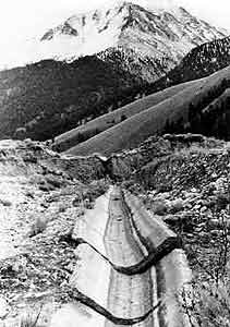
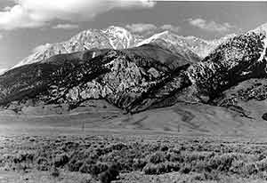
(above) View of Borah Peak and the October 1983 fault scarp looking east from U.S. Highway 93, during a cool and snowy year, (July, 1993). The cliffs in the center of the view are Devonian Jefferson Dolomite. The white rock at the summit is the Silurian Laketown Dolomite. (above left) Borah Peak fault scarp cutting irrigation ditch along Rock Creek, (November, 1983). Scarp is about 2 meters high. View looks south, Borah Peak in background. |
|
 |
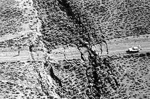 |
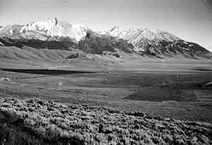
| View of Borah Peak looking south from Willow Creek summit, (July, 1994). A syncline in Lower Paleozoic rocks forms the summit east ridge. | Graben formed along the Borah Peak fault scarp, (October, 1983). Photo taken looking south. Graben was over 2 meters deep. |