|
Page
6
|
Relations
between Geology, Topography and Drainage Systems in Idaho
Topography and
geography are controlled by geologic structure and rock type. The great topographic
diversity of southern Idaho reflects the several geologic provinces of the area.
The southeastern part of the state contains relatively high and moist mountains
and valleys of the Idaho-Wyoming thrust belt. Much of southern and east-central
Idaho north of the Snake River Plain belongs to the arid Basin and Range Province.
The economic heart of agricultural Idaho is the irrigated sagebrush desert of
the Snake River Plain.
 |
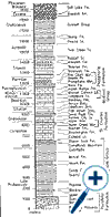
Composite stratigraphic column for the northern Portneuf and Bannock Ranges. Thicknesses from Trimble (1976), Link and LeFebre (1983), and Pogue (1984). Click on image for a larger view. |
North of the plain from Ketchum westward are the high and rugged mountains of central Idaho underlain by the intrusive rocks of the Idaho batholith. Here much of the land is wilderness and tourism has replaced mining as the primary source of income.
Idaho
Drainage Systems and Diverse Geology
The topography
of southern Idaho is varied and dramatic. The fundamental reasons for this diversity
are geological: the recency of volcanism and uplift of ranges along normal faults.
This rough topography reflects a complex geologic past.
Water flows downhill, forming river systems, which effectively cover the earth. These drainage patterns assume great importance to humans, but in eastern Idaho they are in some sense geologic accidents: the result of streams finding routes across areas of recent volcanic activity and uplifted mountain ranges.
 |
Composite stratigraphic column for the Pioneer Mountains west of Mackay (after Link and Hackett, 1988; Link and others, 1992; Link and others, 1996). Click on image for a larger view. |
In geologically mature landscapes, streams tend to follow geologic structure, but in the geologically young landscapes of southern Idaho, stream courses are often either superposed (that is running across older geologic structures that were formerly buried), or disrupted (deranged) by lava flows which act as dams.
River systems carve drainage systems downward toward their ultimate base level. Rivers in southern Idaho over the last twenty million years have drained across active and changing geologic provinces, which have profoundly affected them. In most of southern Idaho water flows into the Snake River and ultimately the Pacific Ocean. However, the Lake Bonneville basin of western Utah, southern Idaho and eastern Nevada is an area of interior drainage. Its base level is the ever-changing level of the evaporating Great Salt Lake.