|
|
 |
|
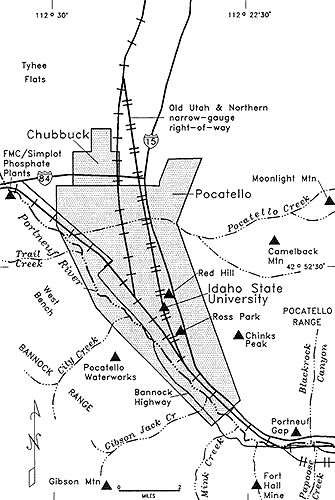
Map
of Pocatello area.
|
Pocatello: The
Gate City
Pocatello, initially a treeless
sagebrush plain, carved from the Fort Hall Indian Reservation, settled by railroaders,
owes its location directly to its geographic setting at the gateway to the Snake
River Plain. Its layout was dictated by the railroad, around which the town was
built. Its politics have reflected a never-affluent, pluralistic blue-collar town
at the edge of Mormon country. These inherent internal conflicts have repeatedly
stymied Pocatello's efforts to become prosperous. It has been a town without an
upper class. In Idaho in the 20th century, things traditionally have come to Pocatello
last. Now, in the 1990s, the prospect of growth and prosperity have returned.
Early
Pocatello: The Townsite and the Indian Reservation
The early community of
Pocatello, from 1882 until 1888, had to exist within the confines of the Oregon
Short Line right of way because the Fort Hall Indian Reservation surrounded
the area. Houses were erected along the west side of the railroad right of way,
with prefabricated buildings moved in from railroad settlements at Omaha, Nebraska,
and few from Battle Creek, Idaho, (north of Preston). Some were moved from Eagle
Rock (Idaho Falls), to Pocatello in 1887. The townsite was too small and trespass
on the Reservation was practiced by many. It was a tense situation.
There were not at first any
churches in the community. A railroad official, who was a Mason, arranged for
a school to be established in one of the railroad houses during the day; upstairs
at night the first Masonic chapter in the area met and on Sundays a Congregational
Church service was held.
top