Geology
of the Snake River Plain
The Snake River
Plain contains Pleistocene basalt and interbedded sediment in the upper few
hundred feet. The Snake River Plain Aquifer, the key to southern Idaho's agricultural
economy, mainly consists of basalts and interbedded sediments, deposited in
Pleistocene time (the last 2 million years). The underlying rhyolite does not
seem to be a major aquifer because many of the pore spaces are filled with chemical
precipitates. Within basalts, permeable zones are mainly the tops and bottoms
of lava flows, with columnar jointing providing vertical transmission of water.
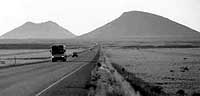
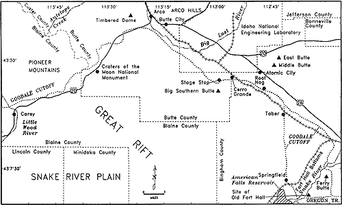
Big Southern Butte
The Big Butte,
elevation 7,560 feet, is a prominent landmark visible from the entire Pocatello-Fort
Hall-Blackfoot-Burley-Arco area. The Butte is a composite rhyolite dome that was
intruded about 300,000 years ago and poked through a capping of basalt lava. This
uplifted lava is now present on the north and east side of the Butte. For more
discussion of the Butte and the surrounding geology see Bonnichsen and Breckenridge
(1982), Pierce and Morgan (1992), and Hackett and Smith (1992).
top