Virtual
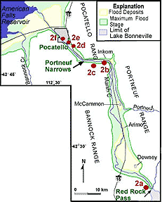
Tour of the Bonneville Floodpath - Red Rock Pass to Pocatello
 |
|
 |
||
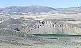
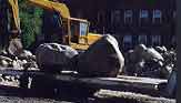
| 2a. Red Rock Pass from west | 2f. Excavation of Bonneville flood boulders at Simplot Square. | |||
 |
 |
|||
|
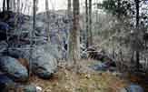
2b. Basalt scoured by Bonneville flood at Inkom, ID |
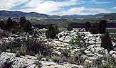
2e. Bonniville floood boulders at Ross Park | |||
 |
 |
 |
||
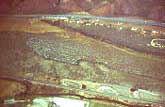
| 2b2. Aerial view of fluted basalts west of Inkom |
2c.
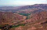
Aerial view of Portneuf narrows from the east.
|
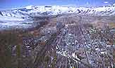
2d. Aerial view of Pocatello looking south | ||
|
|
|
|
Click
on the panoramic thumbnails to view the summit of Red Rock Pass looking
to the north and to the south.
|
|