 |
Hot water bubbling out of the ground has been known about and used in Idaho for hundreds, probably thousands of years. Concentrations of artifacts at and petroglyphs on rocks near hot springs are evidence that the areas were known about and used by Indians. More than 200 hot or warm (thermal) springs occur in Idaho and are distributed throughout several geologic provinces. In order for a spring to be classified as thermal it must be at least 68'F (20'C). Some of Idaho's hot springs reach temperatures as high as 200'F (94'C). Even higher temperatures have been encountered in deep wells.
Origin
of Hot Springs
Hot springs
develop when rain and melted snow waters infiltrate into the ground. This
ground water then sinks deep into the earth and is warmed by the heat contained
in the earth's interior. Because hot water is less dense it is pushed back
to the surface by the continued sinking of heavier, cold water. Annual replenishment
to the system by cold meteoric water creates a continuous system which is
called hydrothermal convection. Hot springs develop when the upwelling hot
water rises along faults or other fractures in the earth's crust and flows
out onto the surface.
Sources
of Heat
 |
|
Public
pools & gardens at
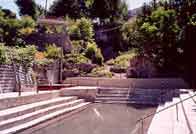
Lava Hot Springs, Idaho |
Another area where the heat of the earth can be concentrated near enough to the surface to generate hydrothermal systems is where the crust of the earth is stretched and thinner than normal. Such a condition exists over southern Idaho in the Snake River Plain and Great Basin areas. A number of large warm water systems occur in this region of Idaho including the Boise, Twin Falls, Bruneau-Grandview, Raft River and Mountain Home systems.
Hot to warm springs also occur within the rocks of the Idaho Batholith. The heat in the batholith is believed to result from the decay of radioactive elements contained in many of the minerals which commonly occur in the granitic rocks.
Relationship
of Faults to Hot Springs
Now that we have
our sources of heat, we need a path for getting the hot water to the surface.
In an active volcanic area such as Yellowstone, faulting is created by upward
pressure exerted by rising magma, by explosive eruptions, and by deflation
of a depleted magma chamber after an eruption. The latter mechanism is the
most common and forms what is called a ring fracture system which approximates
the outline of the magma chamber. Yellowstone has the added advantage of being
astride a zone of active northsouth to northwest-trending faults known as
the Intermountain Seismic Belt. The broken rocks within the fault zones in
Yellowstone act as an excellent conduit for circulating ground water.
The Snake River Plain and Great Basin area of southern Idaho are being stretched. This is a very advantageous geologic situation for the formation of hydrothermal systems because this not only creates a thin crust to bring heat closer to the surface but it also develops numerous normal faults and keeps them relatively open so that water can easily circulate through them.
Hot springs in the batholith are also the result of deep circulation of ground water in fault zones. It appears from recent geologic mapping that some of the normal faults of the Great Basin continue into the batholith. The batholith has also been subjected to other episodes of faulting.
Mineral
Deposits
An interesting feature
of hot springs is their associated mineral deposits. Yellowstone, for example,
contains several types of hot springs deposits, some of which have resulted
in spectacular rock formations.
 Minerals
are more readily dissolved in hot water. The type of minerals deposited depends
on the temperature of the water and the type of rocks it passes through on
its way to the surface. Mammoth Hot Springs in Yellowstone is a large hot
spring deposit of calcium carbonate (calcite).
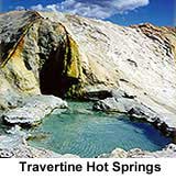
Table Rock near Boise is a hot spring deposit composed of silica, mostly in the form of chalcedony. At Mammoth Hot Springs the hot water is rising along faults in Paleozoic-age limestone which is composed almost entirely of calcium carbonate. The relationship here is evident. Hot water dissolves the calcium carbonate at depth, transports it to the surface and then redeposits it at the surface as the water cools and loses its ability to keep the minerals in solution.
At Table Rock the hot water passes through mostly volcanic rocks and some sedimentary rocks that have been derived from the granitic rocks of the Idaho Batholith. These types of rocks generally contain about 60 to 70% silica. Once again the relationship is evident. Hot water dissolves the silica out of the rocks and redeposits it near the surface as the water cools and the silica drops out of solution.
Boise
Geothermal System
To put our concepts
to work and reinforce them let's take a look at an individual system. The
Boise system is one of the most studied within Idaho and is generally representative
of systems in the southern part of the state. This system is located on the
northern margin of the western Snake River Plain graben. The heat source for
this area of Idaho is the stretched and relatively thin crust. For reasons
that are not well understood the heat in the western Snake River Plain is
concentrated along the margins of the Plain. This is fortunate because the
faults along which the plain is downdropped also occur along the margin. The
main Boise Front fault can be readily seen as a distinct topographic break
between the plain and mountains along the north edge of Boise. Comparison
of rocks in the foothills of the Boise Front with those encountered in wells
drilled in the plain has further confirmed the existence of offset along this
fault and in fact has made possible the identification of a series of faults.
The water of the Boise system circulates to depth along this series of faults,
is heated, and is driven back to the surface by hydrothermal convection. In
Boise, springs no longer flow at the surface because wells drilled into the
fault zone to tap the hot water have intercepted and withdrawn the hot water
rapidly enough that it no longer reaches the surface.
 |
|
Hot
Springs- Preston, Idaho
|
There is an interesting feature of the Boise system that may explain why it and other systems along the margin of the plain are located where they are. Recent geologic mapping has identified a major northeast-trending fracture system within the Idaho Batholith which appears to extend through the Boise geothermal area. This fracture system provides an excellent channel for the ample meteoric water which falls as rain and snow on the Boise Front to infiltrate into the ground and finally into the high temperature zones along the margin of the Snake River Plain. Further work may make it possible to correlate other fracture systems in the batholith to hot springs along the northern margin of the Snake River Plain and thus explain why hot springs do not occur at regularly-spaced intervals.
Geothermal
Energy
In recent years
hot spring systems, also known as geothermal systems, have become an important
source of alternative energy. In a few rare locations in the world, water
in the ground is hot enough to exist as steam. In these instances, wells have
been drilled into the heart of the steam zone and the steam is used to operate
a steam turbine to generate electricity. Such systems exist at Yellowstone
but will not be developed because they are within a National Park. The more
common type of geothermal system is the hot water type such as occurs in southern
Idaho. Electricity has been experimentally generated in the Raft River area
south of Malta but further research and development are needed before commercial
operations can begin. Boise boasts the oldest geothermal heating system in
the United States. In operation since 1890, the system now serves about 400
homes and is tied in to eight major downtown buildings. Other applications
in southern Idaho include the use of warm water for fish farming and greenhouse
heating.