|
Page
4
|
Introduction
to Geologic Diagrams
One of the premises of this
book is that much of the geographic and economic history of southern Idaho is
controlled by its geology. Thus a basic understanding of that geologic history
is necessary to more fully appreciate the anthropocentric, indeed, Eurocentric,
events of the last 150 years.
 |
| Geologic
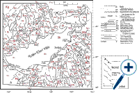
map of eastern Idaho (modified from IGS map). Click on image for a larger view [1175 x 780pxls @ 102kb]. |
Geologists work with geologic maps, which show, instead of the topography, the rock type and geologic structure. A geologic map shows the rock or sediment type that one would find at a certain place.
A second type of standard geologic diagram is the stratigraphic column, which shows the sedimentary rocks present in an area as if they were stacked on top of each other like a layer cake. Such stratigraphic columns are synthesized, in deformed country like Idaho, from exposures in different mountain ranges.
A third standard geologic diagram is a cross section, which views the earth as if it were cut open and seen from the side. Geologic cross sections are interpretative, since the relations can generally not be observed directly. Only in areas of deep canyons or high mountains can natural cross sections be observed. In most cases cross sections require inference about subsurface structure. Sometimes drill holes or geophysical exploration provide data from which cross sections can be constructed.