|
|||
| Chapter 19: Founding of Fort Hall Route of the Oregon Trail in the Fort Hall Area Blackfoot Gay Mine |
Sidebars: |
||
 |
|||
|
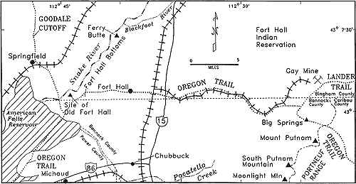
Map
of the Fort Hall area.
|
|||
| Founding
of Fort Hall Unfurling an American flag actually was a violation of the Treaty of Ghent ending the War of 1812, which provided that the northwest should be jointly occupied by the U.S. and Great Britain. Fort Hall was actively used first as a fur trading outpost by Andrew Wyeth and associates, and after 1837, by the Hudson's Bay Company. It was closed in 1856. |
|||
 |
 |
||
|
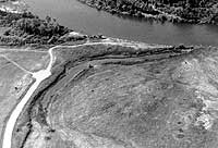
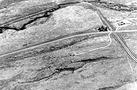
(left) Site of Old Fort Hall on the south bank of the Snake River. The Fort was located about at the small white monument between the slough and the sharp curve in the dirt road. A remnant of the Oregon Trail branch to the Fort can be seen cutting obliquely across the field in the middle of the photograph, (June, 1992). (right) Oregon Trail ruts along Lone Pine (Gay Mine) Road on the Fort Hall Indian Reservation, aerial view looking south, September, 1988. The Gay Mine railway crosses the road in the middle right part of view. Several paths of ruts can be distinguished on the north side of the road, east of the rail crossing. Ross Fork is in the distance meandering through cliffs of basalt. |
|||
|
Osborne Russell's journal states:
|