The crust of the earth is constantly moving. However, with the exception of faults accompanied by earthquakes, this rate of movement is far too slow to notice. In the mountain ranges of Idaho, movement generally occurs at a much higher rate than it does in the more stable interior of the continent.
The movement of a part of the crust creates a
stress. A stress is a force that is applied to a body of rock in such a way
as to change its shape or size. The body of rock affected may range from microscopic
to continental in size. The adjustment to the body of rock is called strain.
Strain, then, is the adjustment of the rock unit in response to stress. Stress
may be
(1) compressive, which shortens the rock body,
(2) tensional, which elongates the rock body, or
(3) shear, where the forces are parallel but in opposite directions.
In solid material like rock, stress can cause three types of strain or deformation: plastic, elastic and fracture. In plastic deformation, the rock is molded or changed in shape under stress and does not return to its original shape when the stress is released. For example, silly putty changes shape when squeezed between your fingers and does not return to its original shape when the pressure is released. This is an example of plastic deformation. In elastic deformation the rocks may partly return to their original form after stress is released. If the rock responds to stress by cracking or fracturing, it breaks. Common examples of fractures are faults and joints. Typically, rocks initially yield to stress plastically and then fracture. In most cases the movement of rock is very slow, generally several millimeters or less per year.
Strike and Dip
Strike and dip are two terms used to describe the extent and direction of tilting of fractures and layering (bedding and foliation) of rock. This is determined by relating the inclined surface to an imaginary horizontal plane.
Strike is the compass direction of a line formed
by the intersection of an inclined plane (tilted bedding or fault plane) with
an imaginary horizontal plane. Dip has two components: the angle of dip is
measured downward from the horizontal plane to the bedding the direction of
dip is the compass direction in which the angle of a dip is measured. The
dip would be the direction a ball would follow down a tilted surface. The
dip angle is always measured at right angles to the strike. Geologists use
the symbols ![]() to denote strike and dip, the strike is the long line and the short line indicates
the direction of dip. A small number beside the symbol indicates the angle
of dip. In this case the tilted bed is dipping 40 degrees from the horizontal.
Geologists
use a specially designed compass called a Brunton to take these measurements.
to denote strike and dip, the strike is the long line and the short line indicates
the direction of dip. A small number beside the symbol indicates the angle
of dip. In this case the tilted bed is dipping 40 degrees from the horizontal.
Geologists
use a specially designed compass called a Brunton to take these measurements.
Block diagram shows relationship of strike and dip to a horizontal plane.
Folds
Folds are bends in rock layers generally caused by compression. Typically there are a series of arches (upfolds) and troughs (downfolds). This type of deformation is plastic so the rocks were probably buried deeply in the earth's crust when the folding occurred. High temperatures and pressures deep in the crust allow rocks to deform as a plastic rather than break. On the other hand fractures such as faults and joints occur near the surface where the rock is cold and brittle. Therefore you can see that the type of deformation, plastic or fracture, indicates the level in the crust where the deformation occurred.
Several terms are necessary to describe and interpret a series of folds. An anticline is an upfold or arch and where layers dip away from the axis (or hinge line). A syncline is a downfold or arch. Synclines and anticlines are typically plunging folds. In a plunging fold the axes are not horizontal. In a dome, the beds dip away from a central point and in a structural basin the beds dip towards a central point. Folds exist in all sizes from microscopic to more than a half mile in height. basic types of folds include: open folds - caused by mild compressional stress isoclinal folds - caused by intense compressional stress; limbs of the fold are parallel. Overturned folds - the limbs dip in the same direction recumbent fold - overturned to such a degree that the limbs are nearly horizontal.
Fractures
If a rock is brittle, it may rupture or break under stress. Most rock near the earth's surface is brittle so almost every exposure of bedrock is cut by fractures. There are two types of fractures in rock: joints and faults. A joint is a fracture along which no movement has taken place. Tensional forces generally cause joints. A fault is a fracture or break in the rock along which movement has taken place. The rupture and subsequent movement may be caused by tensional, compressional or shear forces.
Joints
Joints are fractures in rock where no displacement has occurred along the fracture surface. Columnar jointing is a specialized type of jointing common to volcanic flows. Hexagonal columns form in response to contraction of a cooling lava flow. Exfoliation (or sheeting) is another specialized type of joint generally caused by expansion parallel to the weathering surface. Where closely spaced joints are parallel, they make up a Joint set. These Joints may be spaced from several inches to tens of feet apart. Typically rock exposures exhibit two or more joint sets. The study of joints is important for site evaluations for dams because jointing can affect the permeability and strength of the rock. Joints are also important as a plumbing system for hot water systems and the emplacement of mineral deposits.
Faults
Faults are fractures in rock along which movement has taken place parallel to the fracture plane. Many faults are active; that is, movement has taken place during historical times. Where faults are exposed in bedrock the geologist looks for evidence of displacement or offset features to determine the amount of displacement and the relative direction of movement. Fault planes or zones vary considerably in thickness. Some are just a thin crack in the rock, whereas others may consist of a brecciated and sheared zone up to 1,000 feet wide. Faults also range in length from several feet or less to hundreds of miles. For example the San Andreas Fault extends about 620 miles through western California, slowly moving Los Angeles toward San Francisco. The current rate of movement averages about one inch per year so it will take about 25 million years to make Los Angeles a western suburb of San Francisco. During the 1906 earthquake that devastated much of San Francisco, bedrock along the fault was displaced as much as 15 feet. This was determined by measuring the amount of displacement along features such as roads and fences offset by the fault. The total displacement along the fault is probably about 300 miles since movement began about 30 million years ago.
Types of Faults
The three major types of faults include normal or gravity faults, reverse or thrust faults and strike-slip or transcurrent faults.
A normal fault is one along which the hanging wall has moved down relative to the footwall. The fault plane of normal faults typically dips at an angle of 60 degrees from the horizontal. The normal fault is the most common type of fault that you can expect to see in the field. The largest and most impressive group of normal faults are those that form the fault blocks that make up the Basin and Range Province of eastern Idaho. Normal faults are caused by rupture in response to tensional forces. Because the rock is pulled apart rather than pushed together, the broken area has much space available for ore solutions to move in and precipitate. Most lode or vein deposits are formed in normal fault zones.
In a reverse fault, the hanging wall moves up relative to the footwall. The fault plane is typically inclined 30 degrees from the horizontal, but may vary significantly from this. Reverse faults are not nearly as common as gravity or normal faults.
A thrust fault is a type of reverse fault that is characterized by a low angle of inclination of the fault plane. In fact the fault plane is commonly horizontal or subhorizontal. Both reverse and thrust faults are caused by rupture in response to compressional forces. Eastern Idaho has many exceptional examples of large thrust faults where the upper plate has moved from west to cast tens of miles placing older rocks over younger rocks.
A strike-slip fault is one along which the movement has been parallel to the strike of the fault plane and is caused by rupture in response to shear forces. If an observer looks along the strike of a left-lateral, strike-slip fault, the relative movement has been such that the left-hand side has moved towards the observer. Along a right lateral, strike-slip fault, the block on the right has moved towards the observer.
Earthquakes
An earthquake is a shaking of the ground caused by a sudden release of energy
stored in the earth's crust. This happens when stresses build up in certain
parts of the crust until suddenly a rupture (fault) occurs and energy waves
are sent out through the earth. Volcanic activity can also cause earthquakes.
These energy waves sent out by an earthquake are called seismic waves. The
movement of the seismic waves through the ground during an earthquake causes
the ground to shake. The focus of an earthquake is the point within the earth
where seismic waves originate. The focus is normally centered on the part
of a fault that has the greatest movement. The epicenter of an earthquake
lies on the earth's surface, directly above the focus.
Measuring an Earthquake's Size
The size of an earthquake is directly related to the amount of energy
released at its focus. Two parameters are used to show the size of an earthquake:
magnitude (energy released), and intensity (damage caused). The American seismologist,
Charles F. Richter, devised the Richter scale to measure the total amount
of energy released by an earthquake. This scale, which is recorded by seismographs,
is quantitative and measures a quake independently of its effects. The Richter
Scale uses numbers from 1 on up to describe magnitude. Each number represents
an earthquake ten times stronger than the next lower number. For example,
an earthquake with a magnitude of 5 is ten times stronger than an earthquake
with a magnitude of 4. An earthquake with a magnitude of 7 or higher is a
major quake. The strongest earthquake on record had a magnitude of 9.5 on
the revised Richter Scale (Chile, 1960). The 1906 San Francisco earthquake
registered 7.9 on the revised Richter Scale and the 1983 eastern Idaho Borah
Peak earthquake had a magnitude of 7.3.
The modified Mercalli scale is a measure of the intensity of an earthquake
and is expressed in terms of the physical damage caused by an earthquake or
how much it was felt. The advantage of the Mercalli or intensity scale is
that historical earthquakes can be studied using the descriptions of the events
recorded in old newspaper articles, diaries, etc and an approximation can
be applied to the earthquake as to the magnitude and the epicenter. It uses
Roman numerals from I to XII describing physical, observable signs, such
as not felt at all, or walls in buildings cracked. It is an approximate indication
of how much the earth shook at a given place near the earthquake. Damage decreases
as distance from the epicenter increases.
COMPARE
Mercalli & Richter scales
Seismic Waves
A seismogram is the record of an earthquake made by a seismograph. The seismogram shows the duration and the severity of the shock.

Look at a few types of seismographs:
* Portable
* Schematic
1
* Schematic
2
There are two types of seismic waves: body waves
(P waves and S waves) which move through the earth's interior and surface
waves (L waves) which move along the earth's surface. The time intervals between
first arrivals of P, S, and L waves are used to calculate the distance between
a seismograph and an epicenter. At least three stations are necessary to determine
the location of earthquakes. Earthquakes that originate beneath the ocean
generally cause great waves of water called tsunamis or seismic seawaves.
These waves travel at speeds of up to 500 miles per hour and may reach 200
feet in height when they reach land. Earthquake waves (seismic waves) are
detected and recorded with an instrument called a seismograph.
Effects of Earthquakes
Ground motion is the shaking of the ground that causes buildings to vibrate. Large structures such as office buildings, dams and bridges may collapse. Fire may cause much damage after an earthquake. Broken gas lines and fallen electrical wires cause fires, while broken water lines hinder the capability of controlling fires. Landslides are commonly caused by earthquakes. For example, in 1920 more than 100,000 people were killed in China by the collapse of a cliff. Displacement of the land surface occurs along a fault line. Both streams and roads were vertically offset by the Idaho earthquake.
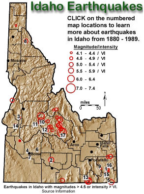
Earthquakes in Idaho
The majority of Earthquakes in Idaho today are a result of Basin and Range extension and volcanism associated with the Yellowstone Hot Spot. The Lost River Range is one of several northwest trending mountain ranges in east central Idaho where the topography is typical of the Basin and Range Province. Ranges are separated by broad sediment filled valleys, and have range-front faults on their southwest flanks. There is also a zone of seismic activity that surrounds the fringes of the Yellowstone Hot Spot track, which for Idaho is another major cause for earthquakes. Notice though that right in the path of the hot spot that there is basically no earthquake activity at all.
Earthquakes occur when the internal forces of Earth are out of balance with those at its surface, sometimes resulting in surface ruptures and ground movement. These imbalances occur in many geological settings that result from the movement of plates over the Earth’s surface. The individual plates either converge (collide), basically causing the crust to wrinkle, or diverge (pull apart), stretching and thinning the crust until it breaks or tears. This type of earthquake activity is called tectonism.
Another cause of earthquakes is the movement of the plates over hot spots; which are areas where massive amounts of heat get transferred from Earth’s core. Rock melts when heat migrates upward, and the surrounding, weakened, lithosphere bends upward causing faults. Further faulting may occur after a volcano falls back into it’s empty magma chamber. Earthquakes associated with this type of activity is called volcanism. Idaho’s earthquake activity is caused by both tectonism and volcanism.
Idaho sits on the western edge of the North American plate which converges with an oceanic plate in the northwest and slides past another oceanic plate along the southwestern boundary. Tectonic forces arise from the interaction of the North American plate with these oceanic plates. The western boundary was totally collisional through part of the geologic past creating stress in both plates that resulted in thrust faults throughout Idaho.
The collisional stresses changed about 60 million years ago to tensional (pulling apart) stresses creating what is now called the Basin and Range faulting throughout the western states. The Mount Borah earthquake was one of the two largest earthquakes recorded on the North American plate in modern history. The quake measured 7.3 on the Richter scale and moved a whole mountain nearly 16 vertical feet. The rupture, or tear in the crust at the Earth’s surface is what geologists call a fault scarp. The high relief and linear northward-trending mountain ranges in the Lost River Range region and elsewhere in the Basin and Range Province have been produced by similar repeated fault movements over geologic time.
Click here to learn more about the Borah Peak earthquake.
Volcanism occurs when heated, molten rock (magma) breaks Earth’s surface. Volcanism causes earthquakes before, during and after they erupt. Earthquakes occur before eruption because the Earth must react to accommodate: 1) expanding material as it melts, and 2) migrating magma. During eruption, earthquakes occur primarily to accommodate the movement of material. Post eruption quaking is generally a response to settling over an emptied magma chamber. The chamber no longer exerts outward forces and is a void with miles of rock above it. Earthquakes caused by a collapsing roof form ring structures, or calderas, which are circular depressions over a volcanic center. The second of the two largest North American earthquakes was a response to volcanism. The Hebgen Lake earthquake occurred just north of the Idaho border near Yellowstone Park. Geologists think it was a result of magma moving under the Yellowstone caldera. It measured 7.5 on the Richter scale.
Many of Idaho’s cities are at risk to earthquakes, even small ones, because many were built on unconsolidated sediments that move easily in response to seismic waves. Seismic waves are the form of energy that ripples through Earth when an earthquake occurs. When seismic waves propagate through unconsolidated sediments the sediments re-organize and move chaotically (sort of shaking like a bowl of gelatin). The danger is really two fold because those cities which were built near rivers below the foothills and mountains eventually expanded upward into the foothills. Mountain foothills contain erosional remnants called alluvial fans. The alluvial fans may either slide down into the valley or simply shake about creating new topography due to internal settling. For this reason, Idaho ranks fifth in the lower 48 states as to its earthquake hazard.
Click here to open a database of Idaho Earthquakes. This is in Excel.
Go visit a fun web site with animated graphics that explain earthquakes.
ALSO VISIT a USGS web site about Idaho earthquakes.
|
Supplemental Material The field guides below are a part of the Guidebook to the Geology of Eastern Idaho : |
||
|
|